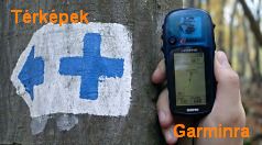
turistautak.hu térképrészleteK+ jelzés GPS-szel
[ english
Előzmények

CacheFinderhozzászólásai | válasz erre | 2014.09.25 21:21:56 (72099)
Örülni kell neki! Ebből is tudhatjuk, hogy egy szinte tökéletes készülékünk van! :D
[előzmény: (72097) Bryan, 2014.09.25 21:08:34]

Bryanhozzászólásai | válasz erre | 2014.09.25 21:08:34 (72097)
Reméljük szombaton azért nem fog meglepetés érni :D
Ha közel 3 hónap alatt csak ennyire tellett a Garmintól, akkor eléggé elszomorító a helyzet!
[előzmény: (72096) CacheFinder, 2014.09.25 21:00:26]

CacheFinderhozzászólásai | válasz erre | 2014.09.25 21:00:26 (72096)
Köszi az infót!
Ez nem sok. Remélem, hogy azért sok apró hibát kijavítottak, csak nem dokumentálták.
[előzmény: (72095) Bryan, 2014.09.25 19:56:53]

Bryanhozzászólásai | válasz erre | 2014.09.25 19:56:53 (72095)
Új firmware az Oregon 6x0 szériához: v4.20

Changes made from version 4.10 to 4.20:
Improved cartography support
Improved boot time when a large amount of BirdsEye satellite imagery is present

Changes from version 3.90 to version 4.10:
Fixed issue with barometer when auto calibration is turned off.
Fixed Cyrillic cardinal direction characters in waypoint position editing.
Fixed missing ascent, descent, and elevation statistics when reviewing certain tracks.
Fixed issue with geocaching 'Next Stage' feature.
Fixed possible shutdown when using custom waypoint symbols.

Changes from version 3.80 to version 3.90:
Improved average ascent and average descent data fields
Improved vertical speed and grade data fields

Changes from version 3.60 to version 3.80:
Added a separate zoom level setting for geocaches (Setup > Map > Advanced Map Setup > Zoom Levels > Geocaches)
Added support for additional ActiveRouting cartography
Improved GLONASS performance
Improved display of marine-specific lines in BlueChart g2 maps
Improved boot time when large amounts of photos are present
Fixed map display of highway shields
Fixed issue with incorrect letter capitalization of certain map points
Fixed issue retrieving PLSS data in certain TOPO US 24k maps
Fixed possible issue with /- buttons when using Sight N' Go
[előzmény: (71629) Bryan, 2014.07.03 22:14:49]

Bryanhozzászólásai | válasz erre | 2014.07.03 22:14:49 (71629)
Új firmware az Oregon 6x0 szériához: v4.10

Changes from version 3.90 to version 4.10:
Fixed issue with barometer when auto calibration is turned off.
Fixed Cyrillic cardinal direction characters in waypoint position editing.
Fixed missing ascent, descent, and elevation statistics when reviewing certain tracks.
Fixed issue with geocaching 'Next Stage' feature.
Fixed possible shutdown when using custom waypoint symbols.

Changes from version 3.80 to version 3.90:
Improved average ascent and average descent data fields
Improved vertical speed and grade data fields

Changes from version 3.60 to version 3.80:
Added a separate zoom level setting for geocaches (Setup > Map > Advanced Map Setup > Zoom Levels > Geocaches)
Added support for additional ActiveRouting cartography
Improved GLONASS performance
Improved display of marine-specific lines in BlueChart g2 maps
Improved boot time when large amounts of photos are present
Fixed map display of highway shields
Fixed issue with incorrect letter capitalization of certain map points
Fixed issue retrieving PLSS data in certain TOPO US 24k maps
Fixed possible issue with /- buttons when using Sight N' Go


Bejelentkezés név:  jelszó:   tárolás [regisztráció]

Felhasználónevedet és jelszavadat a geocaching.hu oldalon is használhatod!

[ kezdőlap ] [ térkép ] [ + felmérések ~ ] [ + útvonalak ~ ] [ + poi ~ ] [ belépés ] [ faq ] [fórum] [email]

A weboldal működése és tartalma folyamatos fejlesztés alatt áll, köszönettel vesszük az észrevételeket a fejlesztési ötletek oldalon.
A turistautak.hu-ra feltöltött track-eket és a letölthető térképeket, azaz térképi adatbázist az ODbL licencnek megfelelően bárki használhatja.
Minden egyéb anyag előzetes írásbeli engedély nélkül csak magáncélra használható fel. jogi tudnivalók